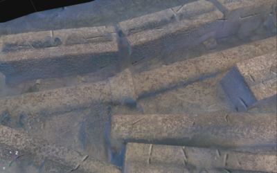
At the bottom of Drøbaksundet in the Oslo Fjord lies one of Norway’s most historically significant wrecks, the German cruiser Blücher. Sunk on April 9th, 1940, during the invasion of Norway, the 200 meter warship has rested upside down for over 80 years. Once only accessible to skilled divers descending nearly 80 meters, the wreck can now be explored in extraordinary detail through a groundbreaking 3D digital reconstruction, powered by Voyis optical technology.
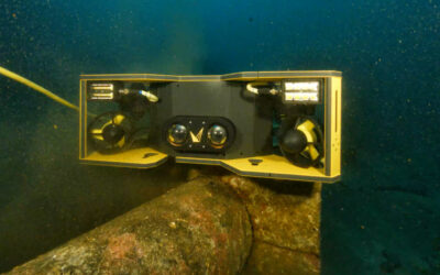
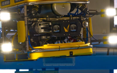
Earlier this year, Submara Prosjekt, commissioned by the Norwegian Coastal Administration (Kystverket), undertook one of the most advanced underwater photogrammetry surveys ever performed in Norwegian waters. Using a Voyis Discovery Stereo Inspection Series camera integrated on a remotely operated vehicle (ROV), the team captured tens of thousands of overlapping high-resolution images of the Blücher. Despite extremely poor visibility, Voyis’ VSLAM technology enabled precise localization and image alignment, ensuring full coverage of the massive wreck and surrounding debris field.
“This is one of the most detailed underwater records of a shipwreck ever made,” said Andrew Reed, Head of Data and Business Development at Submara. “We are very pleased with the result, especially the level of detail. The color correction has removed the green-blue tinge that usually occurs in underwater photogrammetry, revealing the true hues of the wreck as it appears on the seabed.”
The resulting 3D model captures intricate details down to the millimeter, from gun barrels and cables to rivets, torpedoes, and the hull structure itself. Through advanced color correction and dense 3D reconstruction, the model not only preserves the ship’s physical form but also provides vital insight into its condition and history. In fact, the dataset revealed that the vessel sank due to hull breaches, not the torpedo impacts long believed responsible.
Monitoring History to Protect the Future
For the Norwegian Coastal Administration, the Blücher model represents far more than a historical record. It is a critical tool for environmental risk management. The wreck still poses a pollution threat from residual oil and other materials, and 3D mapping enables authorities to track structural changes, identify new leaks, and model potential collapses with unprecedented accuracy.
Underwater photogrammetry provides the foundation for ongoing monitoring efforts, complementing real-time surveillance cameras installed above the wreck. Repeated surveys at defined intervals will allow Kystverket to measure subtle deformations and movement in the structure, data that can inform future mitigation measures, and ensure rapid response to any new environmental incidents.
Technology Illuminating the Unknown
This project demonstrates how modern optical systems are redefining underwater heritage documentation and environmental monitoring. The Voyis Discovery Stereo Inspection Series camera captured crisp, metrically accurate imagery in challenging conditions, while VSLAM (Visual Simultaneous Localization and Mapping) ensured reliable navigation and mapping continuity in extremely low visibility waters.
Together, these technologies provided Submara and Kystverket with a complete, true scale underwater digital twin of the wreck, one that will serve both historical preservation and environmental protection efforts for years to come.
As the Blücher returns to public attention through both cinema and science, this new digital model stands as a testament to how advanced underwater imaging is transforming our understanding of history beneath the waves and protecting the oceans for generations to come.