FOR INSPECTION & WORK CLASS ROVS
ROV Skids
A pre-integrated skid that incorporates all the required sensors for accessible dynamic laser scanning and image mapping
Drastically simplifies integration into your ROV

Our team partners with you to find the best solution
Real-time onboard laser and image data enables automation

Simplifies the creation of digital twins
PRE-INTEGRATED SKID
What is it?
Our small ROV skids for inspection and Work class ROVs help simplify the integration of our laser scanners and imaging systems without impacting vehicle dynamics.
These skids are designed for industry-leading ROV platforms and can be adapted to your existing vehicle.
Pre-configured into neutrally buoyant skids to minimally impact ROV dynamics
Combines our Imaging Systems and Laser Scanners into complete solutions
Incorporates a co-located inertial navigation system (INS) and doppler velocity log (DVL) with factory calibration to avoid in-field patch tests
Enables reliable autonomy with onboard data enhancement
Power distribution and communications through a single connection for the entire skid to drastically improve offshore integration

FOR SURVEYS AND INSPECTIONS
The Lineup
The Voyis ROV skids come pre-integrated with all required interfaces and sensors to help you quickly mobilize ROVs for dynamic 3D laser scanning and colour image mapping.
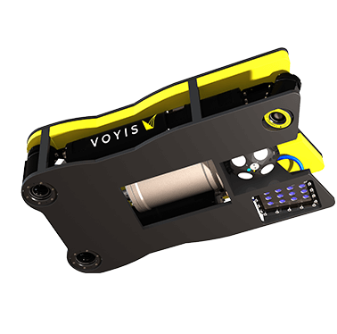
Small ROV Skid
Inspection class skid with options for both laser scanning and imaging sensors, all combined into a neutrally-buoyant package. Comes with INS/DVL sensors.
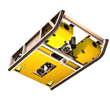
XL ROV Skid
Pre-calibrated Work Class rental skid that has options for both laser scanning and imaging sensors. Comes with INS/DVL sensors and offers a single connection with integrated MUX.

VOYIS ROV SKIDS
Integrations
Our rov skids drastically reduce the risks and complexity commonly associated with piecemeal sensor integrations. These plug-and-play solutions offer fully geo-referenced high-resolution data.
Depending on your vehicle, the skids can be custom fit to the ROV or easily retrofit using the standard mounting pattern on the skid frame of the skid. Power and communication distribution is further simplified with an onboard MUX, providing the ROV with a single interface.
DATA VISUALIZATION
Real-Time Digital Twins

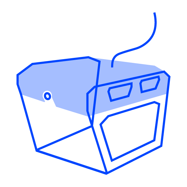
The Voyis ROV skids enable complete high-resolution 3D models of subsea installations, Digital Twins, to be generated in real-time. The ROV simply traverses the area of interest, and navigationally corrected 3D data points are displayed instantaneously for observation and quality control.
Accurate Digital Twin models can be used to evaluate new installations or monitor asset integrity over time using change detection analysis.
Still have a few questions?
Check out our frequently asked questions to learn more about Perception ROV Skids.
How quickly is the laser data available for review?
Volumetric 3D models and high-resolution stills images are cleaned, enhanced, and processed all onboard the sensors in real-time which can be fed to machine learning algorithms.
What is required to outfit my vehicle with an ROV skid?
The Voyis ROV skids are shipped to the customers in a fully assembled, calibrated, and tested package. Users simply mount the skid onto the ROV and connect the single payload interface to the vehicle to provide power and communication. Standard software is installed to configure sensor settings, and real-time data can be viewed through the vehicle’s ethernet or fiber connection.
What format is the data stored in?
The data collected with our underwater laser scanners is saved in a standard format for use with any point-cloud analysis software, including the popular opensource CloudCompare.
What is the data workflow?
All data is processed in real-time and streamed to the topside control computer for instantaneous target assessment. Navigational data can be post-processed for improved accuracy if required for the application. Separate supplier software packages can be provided for optical and navigational sensors, or EIVA survey software can be included for an all-in-one control and analysis package.
Ready To Get Started?
We provide versatile optical solutions to expand your underwater capability and enhance understanding of remote, challenging environments.
Proudly made in Canada 🍁

Contact Us
120 Randall Dr, Unit E
Waterloo, ON
N2V 1C6