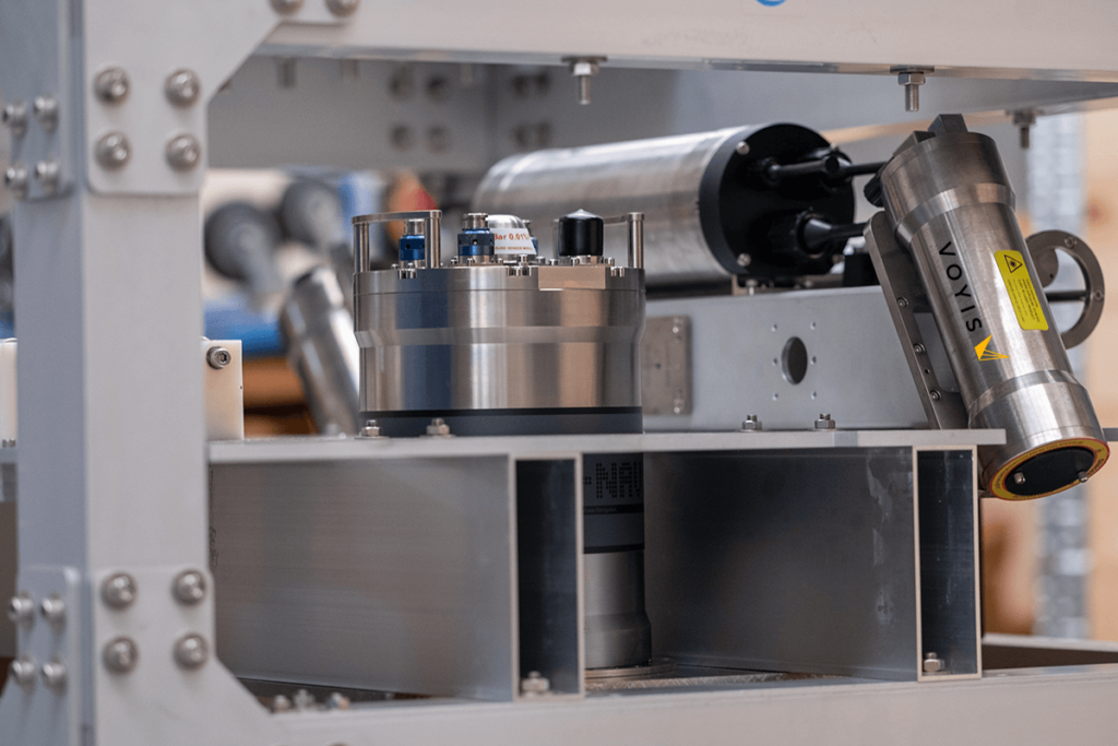
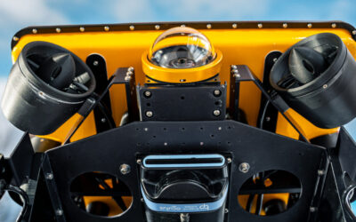
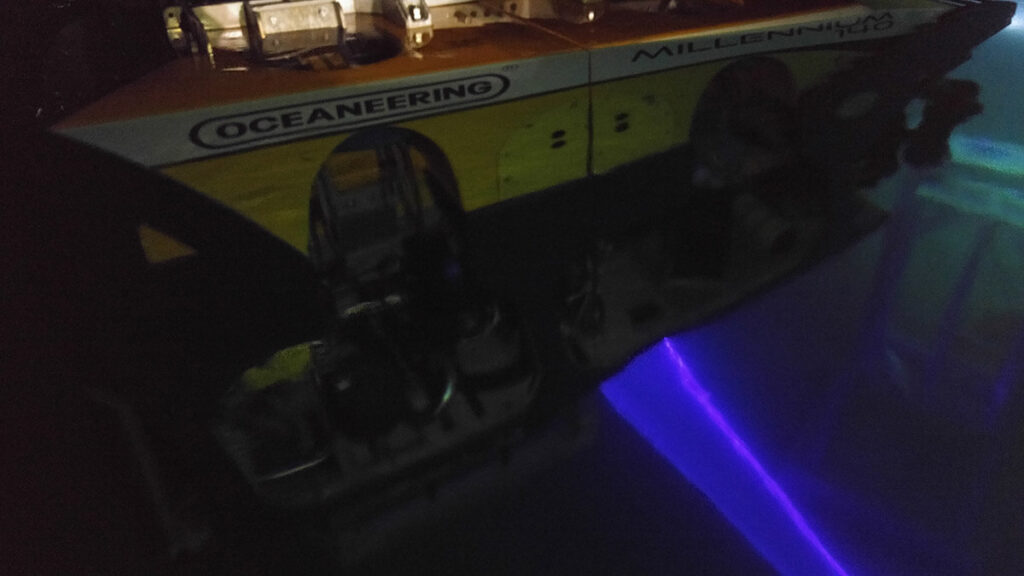
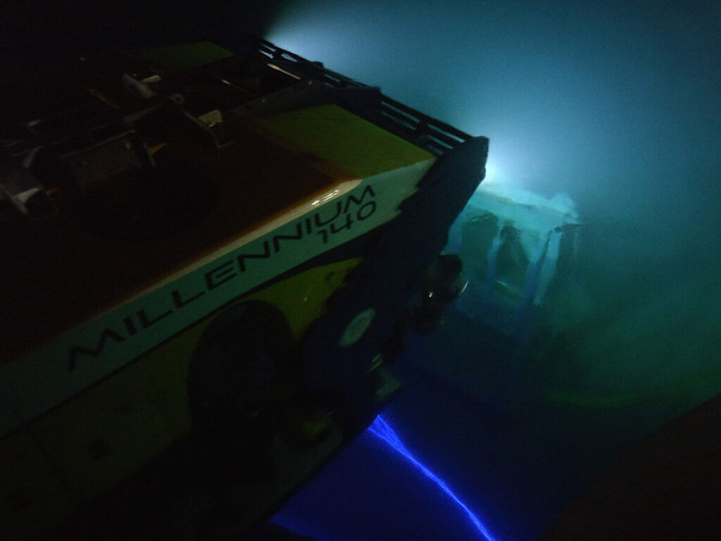
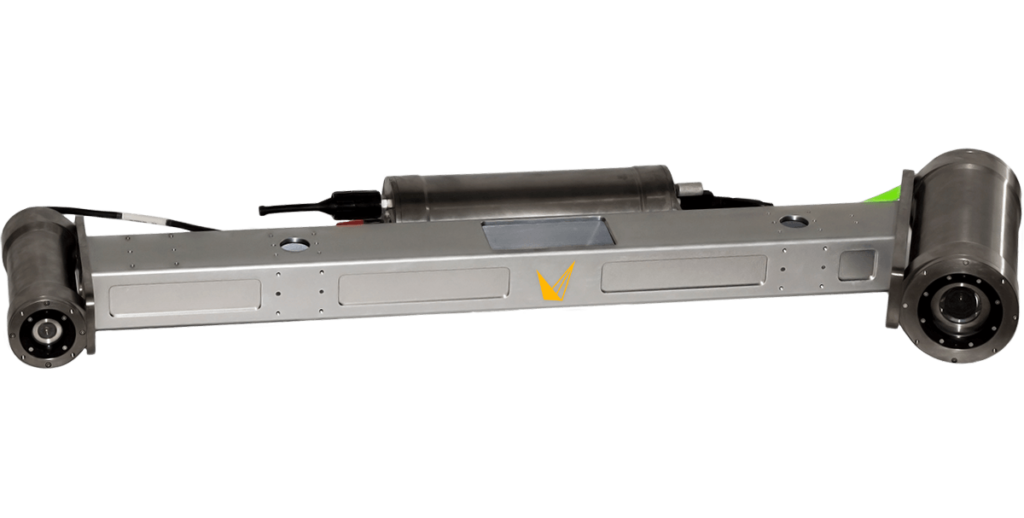
Voyis recently released the Perception XL, a new 4000m rated laser scanning WROV skid specifically designed for generating extremely detailed volumetric point cloud models. The Perception XL enables you to gather incredibly dense data that was previously unachievable at faster ROV speeds. This pre-configured module is capable of delivering highly accurate and precise data of the seafloor and subsea assets, from pipelines to historic wrecks, enabling customers to conduct deepwater laser survey mapping from ROVs.
Simplifying ROV Integration
The Perception XL combines proven commercial products from the Sonardyne Group companies, Voyis, Sonardyne, and EIVA, to create a high precision all-in-one system for underwater dynamic 3D survey and analysis.
It’s a collaboration that started back in 2015 when we saw the benefit of using our technologies together for dynamic laser scanning subsea structures with Apply Capnor. By collecting positioning data from Sonardyne’s SPRINT-Nav (which is a pre-configured package of Sonardyne’s Sprint INS and Syrinx DVL), point cloud data using Voyis’ Insight Pro dynamic underwater laser scanner, and using EIVA Naviscan to amalgamate the datasets, we were able to generate fully georeferenced models that did not require manual point cloud stitching.
The Perception XL WROV Dynamic Laser Scanning Skid alleviates the time consumption and unknown integration woes of piecemeal equipment integrations on deck or dockside. System offsets are pre-defined and fine-tuned in-factory prior to arriving at the customer’s facility, meaning there is no need to waste time patch-testing offshore, no complex system wiring or on-site splicing, and no need to worry about compatibility. The skid even comes equipped with its own multiplexer for a “plug and play” connection. As a bonus, the topside equipment is pre-wired in rack-mount cases.
Why Optical Sensors?
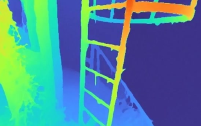
The Insight Pro, including both 4000 m and 6000 m depth rating options, was developed in 2017 and is a staple in the offshore industry for dynamic laser scanning projects. The system is used on surveys where the end customer requires extremely high resolution and accuracy to make educated decisions on the condition of their subsea assets.
The subsea laser offers substantially more detail compared to sonar solutions because it is optically based, generating 2,048 points per laser profile, at a capture rate of 52 — 92 lines per second. Compared to photogrammetry, the laser can provide true details of the structure’s depth and damage, and generate models in shadowed areas, even when there are no defined features because models are built using the geometry of the laser line on the target.
In addition, the 3D laser model is generated in real-time, offering the ability to conduct data QC during survey operations. These capabilities allow users to own their survey with real-time processed models that offer details unobtainable with other subsea solutions.
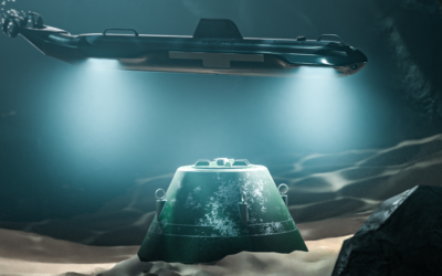
A Deep Water Challenge
To build accurate models in deep water, you need positioning. In shallow waters, you can use surface position updates, usually from an Ultra-Short BaseLine (USBL) system. But highly precise deep water scanning can’t rely on surface position updates. Your main options are using: a local Long BaseLine (LBL) array on the seabed; a sparse LBL array in combination with a good inertial navigation system (INS); or a very good INS.
Optically-based sensors are subject to the refractive properties of the water. While this might be negligible at shallow depths in standard water conditions, at extreme depths, the index of refraction (IOR) of the water column has an even greater impact on system accuracy if using hard-set parameters based on near-surface calibrations. The Voyis Insight Pro accounts for the index of refraction by using CTD values to ensure consistent accuracy at extreme depths, temperatures, or changes in water density.
High Performance Navigation with SPRINT-Nav
The Perception XL comes with a SPRINT-Nav 500 —Sonardyne’s all-in-one, acoustic-inertial subsea navigation instrument for underwater vehicles. SPRINT-Nav’s tight coupling of a SPRINT INS, Syrinx DVL and pressure sensor, with individual beam-level aiding from the DVL, means optimal performance but also that the INS doesn’t suffer drift from DVL dropouts when it goes over obstacles on the seabed or a structure being mapped. Beam-level aiding means if one beam drops out, it doesn’t matter, bottom lock continues. That’s important when performing surveys over ground or objects prone to loss of bottom lock.
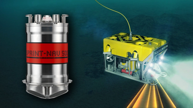
For projects where the use of LBL is limited, the SPRINT-Nav X, the highest grade SPRINT-Nav currently available, can be used in order to allow mapping without using a sparse LBL array and further reduce the INS drift. To give you an idea of its performance, SPRINT-Nav X achieves less than 1 nautical mile error for every 12 hours of unaided inertial navigation and better than 2 m error for every 10 km travelled with Doppler lock. While this option does require extra post-processing of the laser scans, to join them together, the end result is the same and you’ve not had to deploy that LBL array.
Data Collection, Processing, and Visualization
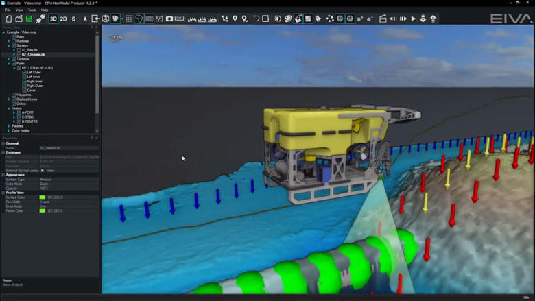
Data collection, processing and visualization can be done by another Sonardyne Group company, EIVA a/s, using their NaviSuite software products – specifically their NaviPac, NaviScan, NaviEdit and NaviModel products.
NaviPac provides real-time positioning and navigation for surface and/or subsea vehicles. Calculated NaviPac positions are sent to NaviScan, which is used to record data from multiple sensors at output high data rates. However, recording sensor data is a small part of any survey operation when the ability to generate customer deliverables is always a necessity, which is why NaviEdit and NaviModel are so important.
NaviEdit allows users to analyze and edit sensor data in its raw form, whilst NaviModel allows us to visualize, interpret and quality control the results, thus allowing us to extract the maximum value from often divergent datasets to generate customer deliverables.
A New Deep-Rated Laser Scanning Skid
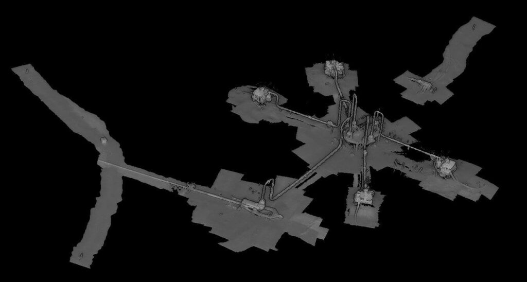
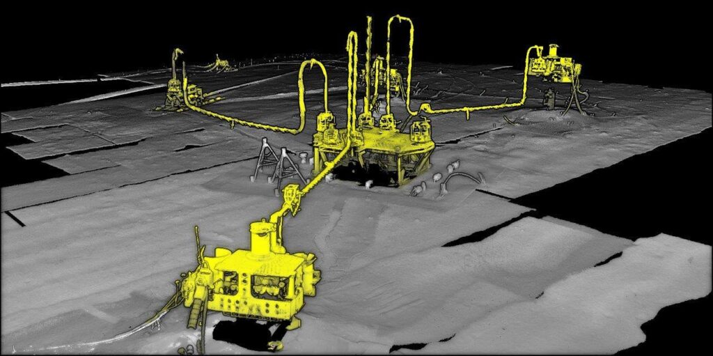
The combined result is a single plug-and-play deep-water rated system able to provide its users with extremely detailed volumetric point cloud models across vast survey areas. The Perception XL can complete repeatable survey work in the deep ocean, all without the hassle of offsets, wiring, and corrections.
This impressive solution can be used for projects such as seabed characterization, subsea structure inspection, metrology, seabed scour monitoring, environmental modelling, or coral mapping. or corrosion modelling. The Perception XL Dynamic Laser Scanning Skid is plug-and-play and ready to go whenever your mission needs it.
So, if you want fully georeferenced models or metrology in deep water environments and without the need for manual point cloud stitching, the deep-rated Voyis Perception XL WROV Dynamic Laser Scanning Skid offers the solution for you.