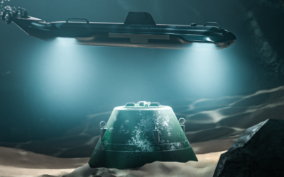
Underwater inspections in challenging environments require advanced technology to overcome obstacles and ensure accurate data acquisition. The Insight Pro, a long-range underwater laser scanner by Voyis, revolutionizes the field of underwater inspections. In this blog, we explore the applications and benefits of a long-range underwater laser scanner, as well as the challenges it addresses. By providing real-time 3D data, enhanced accuracy, and comprehensive coverage, the Insight Pro is transforming the way underwater inspections are conducted.
Overcoming Industry Challenges
Underwater inspections in industries such as offshore energy, marine research, and environmental monitoring face numerous challenges. Harsh environmental conditions, large survey areas, and complex infrastructure make data acquisition a daunting task. Traditional inspection methods, like sonar technology, have limitations in terms of accuracy and resolution. However, the Insight Pro rises above these challenges, offering a solution for long-range underwater scanning.
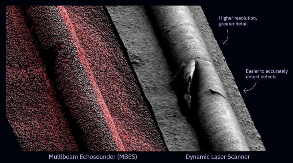
Sonar technology, commonly used for underwater inspections, relies on acoustic signals, and has inherent limitations. Although sonar is a reliable source of generating centimetric resolution models of large areas, customers require greater resolution to make informed and actionable datasets. These limitations prompt the need for a more advanced and precise technology like the Insight Pro.
The Insight Pro Advantage
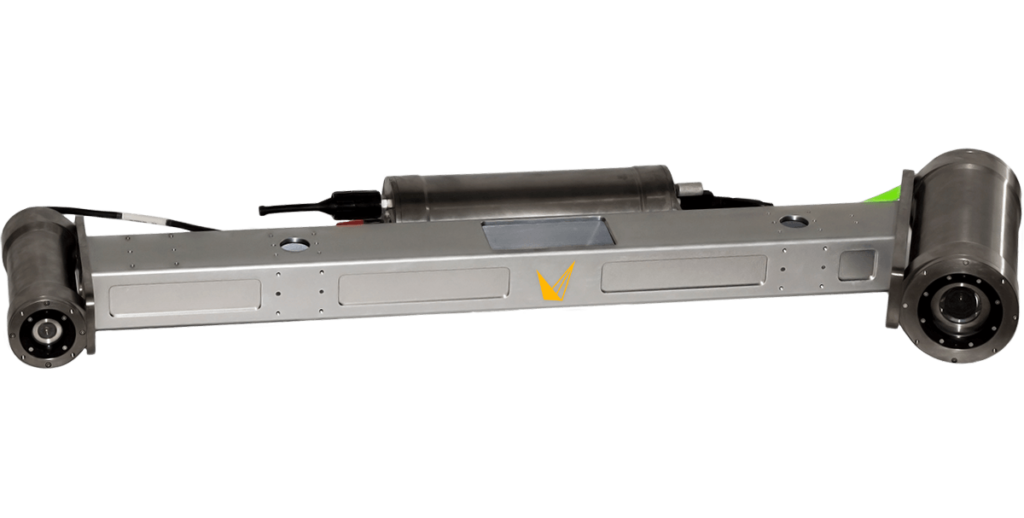
The Insight Pro is a significant change in underwater inspections, offering a range of capabilities that enhance accuracy, efficiency, and safety. With depth rating options of 4000m or 6000m, it enables precise 3D modeling even in the deepest underwater environments, ensuring comprehensive data collection at ranges up to 15m from the seabed.
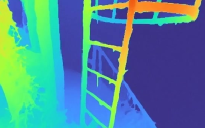
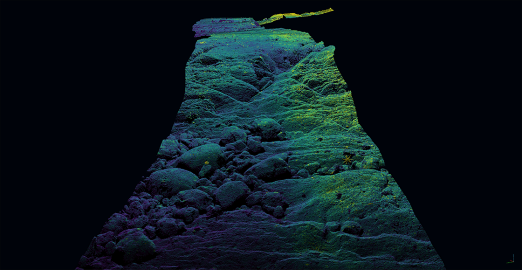
The Insight Pro generates real-time 3D point cloud models, providing operators with precise measurements and a baseline for future comparative scans. This real-time data acquisition significantly reduces inspection time, enabling quick decision-making and immediate analysis. By leveraging the Insight Pro‘s capabilities, operators can gather accurate and up-to-date information during underwater inspections.
The Insight Pro addresses the challenges posed by harsh underwater environments through advanced features. Actively cooled sensors reduce noise and maximize range, ensuring reliable data collection even in extreme conditions. With a 50° laser line and accurate PPS time synchronization with vehicle navigation data, the Insight Pro maximizes coverage, minimizing the chances of missing critical areas during inspections. This comprehensive coverage enhances the accuracy and reliability of the data collected.
Long-range Applications
The Insight Pro‘s applications span across various industries that rely on underwater inspections. It has been successfully used in scanning over 100,000 kilometers of subsea pipelines, providing crucial data for maintenance and integrity management. Offshore wind farms, underwater infrastructure inspections, environmental monitoring, and marine research also benefit from the Insight Pro‘s long-range capabilities offering safe operational distance with maximized laser coverage.
Traditional methods often require close proximity to capture detailed data, which can be challenging and time-consuming, especially in deep waters. However, with the advent of long-range scanning technology, such the Insight Pro, operators can gather precise information from a greater distance.
The applications of long-range underwater inspections are significant. For example, in pipeline surveys, long-range scanning allows operators to assess the condition of subsea pipelines without the need for physical contact or close proximity. This capability is particularly valuable in deep-sea environments where pipelines span vast distances. By eliminating the need for close proximity, long-range inspections enhance efficiency, reduce risks, and enable more extensive coverage of pipeline networks.
Similarly, in offshore infrastructure inspections, long-range scanning plays a crucial role. It enables operators to assess the condition of offshore platforms, underwater structures, and wind farms from a safe distance. This reduces the reliance on remotely operated vehicles (ROVs) to get close to objects, saving time and resources while minimizing potential risks associated with close-proximity inspections.
Moreover, long-range scanning has significant implications for environmental monitoring. It allows researchers to study marine ecosystems, such as coral reefs or underwater habitats, without disturbing the natural environment. By capturing detailed data from a distance, scientists can assess the health and biodiversity of these ecosystems, providing valuable insights for conservation efforts, completely non-intrusive.
The Insight Pro facilitates better decision-making by delivering accurate and real-time 3D point cloud models. It enables operators to not only collect data more effectively with providing data capture ranges at safer operating distances from assets, but also allows users to identify potential issues promptly, take proactive measures, and minimize operational risks through high resolution actionable datasets. By providing comprehensive and accurate data, operators can use the Insight Pro to improve safety by ensuring that inspections are conducted thoroughly, and potential hazards are identified in advance.