High-resolution optical imaging and real-time 3D mapping technology used in NOAA-led expedition
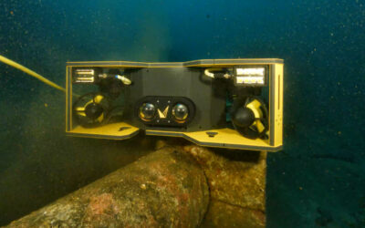
Voyis is proud to announce its participation in a groundbreaking underwater exploration of a newly discovered shipwreck in Lake Ontario. As part of the Lake Ontario National Marine Sanctuary (LONMS) Shipwreck Expedition, the Voyis Discovery Stereo Inspection Series I300 Camera and Voyis VSLAM Powered by EIVA NaviSuite were used to capture detailed visual data of many different shipwrecks.
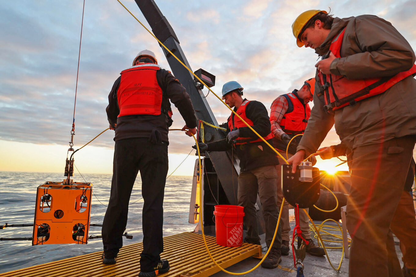
Credit: Marley Parke – Quinlan Fahy (right) holds the clump weight while Stephen Jones and Joe Bevilacqua safely lower the ROV into the water.
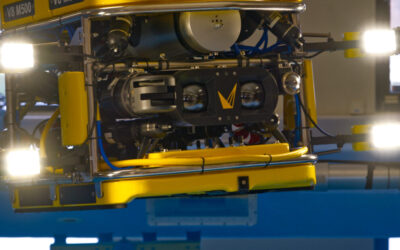
Running from May 17 to 31, the two-week expedition was led by Chief Scientist Dr. Ben Ioset and Expedition Lead Jason Fahy. The mission deployed the Rhody remotely operated vehicle (ROV), owned and operated by URI, developed by JM Robotics. Rhody is a customized version of the HD3 system. The ROV was equipped with advanced optical sensors to perform high-resolution ROV surveys of multiple wrecks within the sanctuary.
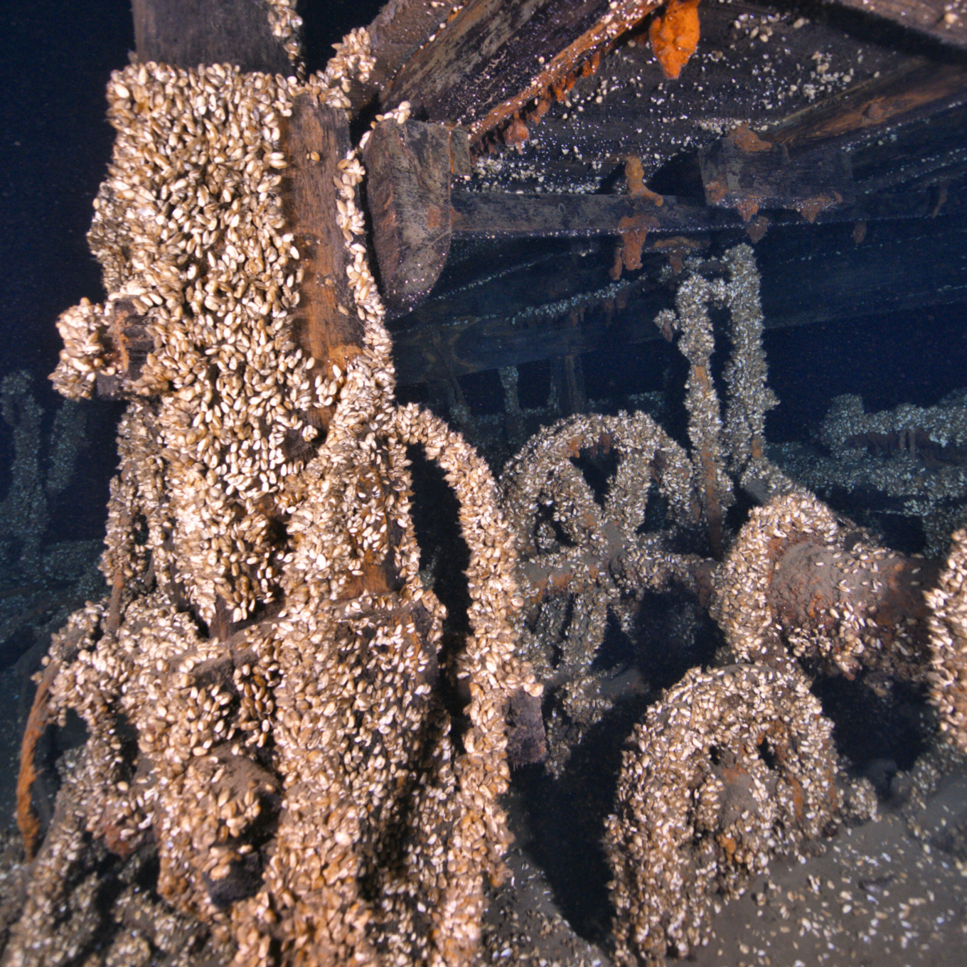
One of the shipwrecks had previously been identified during a NOAA mapping mission but had never been explored before. The Discovery Stereo Inspection Series Camera delivered true-colour, high-definition imagery, revealing fine structural details of the site. When paired with the Voyis VSLAM solution, the team created real-time 3D maps of the underwater environment. This allowed for precise navigation and full area coverage during the survey, enhancing data reliability and eliminating the need for repeat dives.
In addition to that a completely new shipwreck was discovered by the expedition team, and they used the Discovery Stereo Inspection Series to bring it to life for the first time in history.
“Following the Phillip Becker, we headed to a previously undiscovered target that was identified during our overnight mapping. The object was 39m long and 4m off the lake bed making it highly likely to be a shipwreck. Upon reaching the bottom we discovered what is likely an early 1800s steam barge. The VOYIS Discovery Stereo I300 Camera worked flawlessly allowing us to build 3D models of the site in real time. We left the site with an initial 3D model and full 4K video coverage.”
The expedition was funded by the NOAA Office of National Marine Sanctuaries and supported through the Ocean Exploration Cooperative Institute (OECI), which is led by URI’s Graduate School of Oceanography. The Rhody ROV is owned and operated by the URI team.
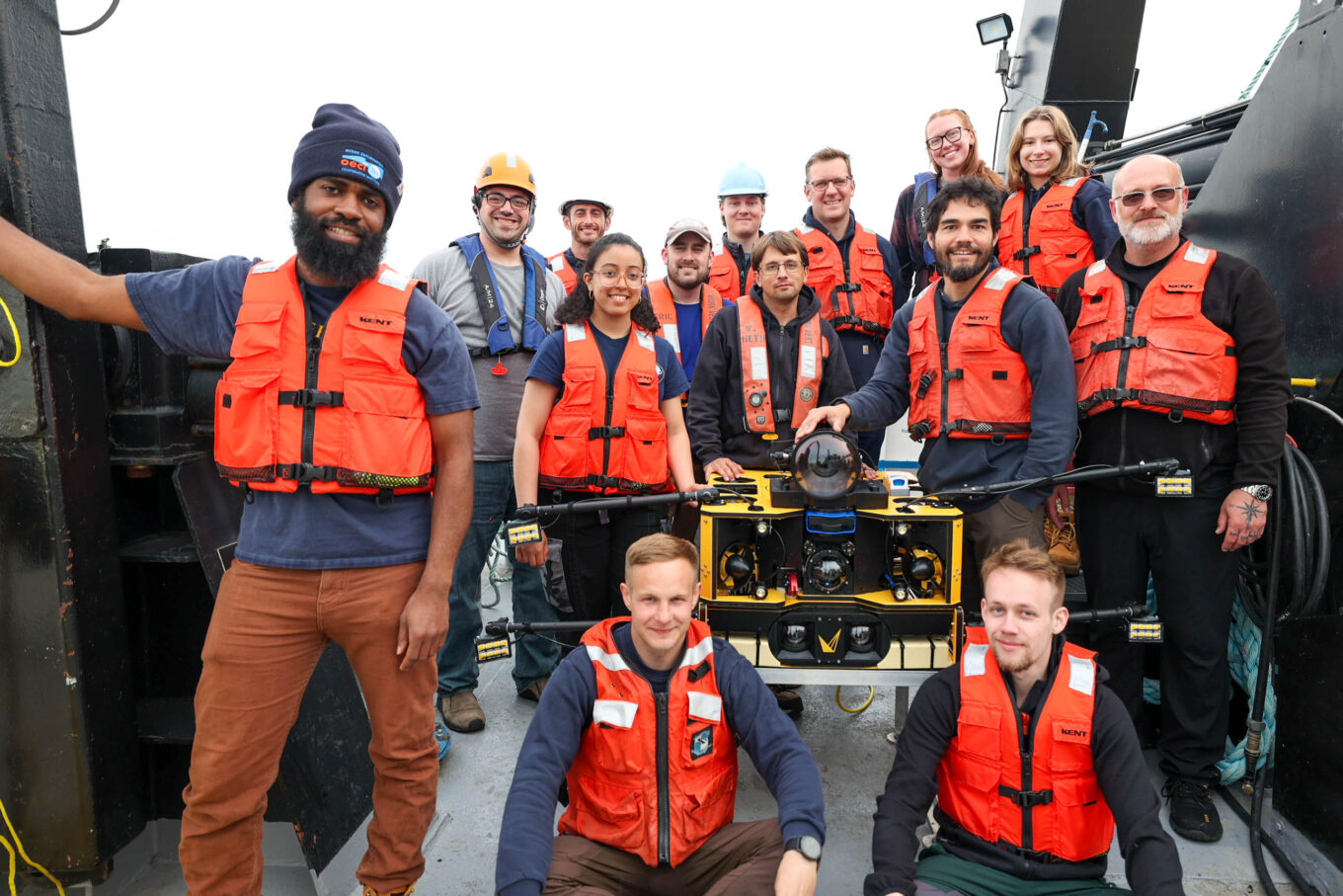
Credit: Marley Parker – Expedition team with ROV and Voyis Discovery Stereo I300 Camera
Public Engagement and Education
As part of its outreach efforts, NOAA livestreamed the dive on YouTube, allowing the public to virtually join the exploration in real time. In addition, the expedition team hosted 15 live ship-to-shore sessions with local schools, conducted ship tours, and engaged more than 740 students, educators, and community members in hands-on learning about underwater archaeology and marine technology.
A New Chapter in Underwater Discovery
Voyis is honored to contribute to this significant maritime discovery and proud to support NOAA’s mission to explore, understand, and protect underwater cultural heritage. The successful use of advanced underwater optical sensors and real-time 3D positioning highlights the growing role of technology in modern ocean exploration.
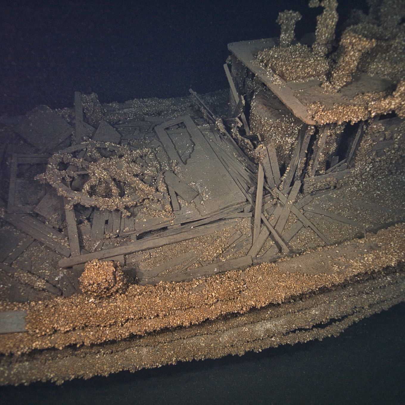
Credit: NOAA ONMS/OECI
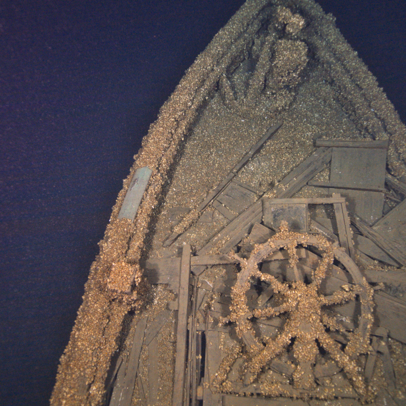
Credit: NOAA ONMS/OECI
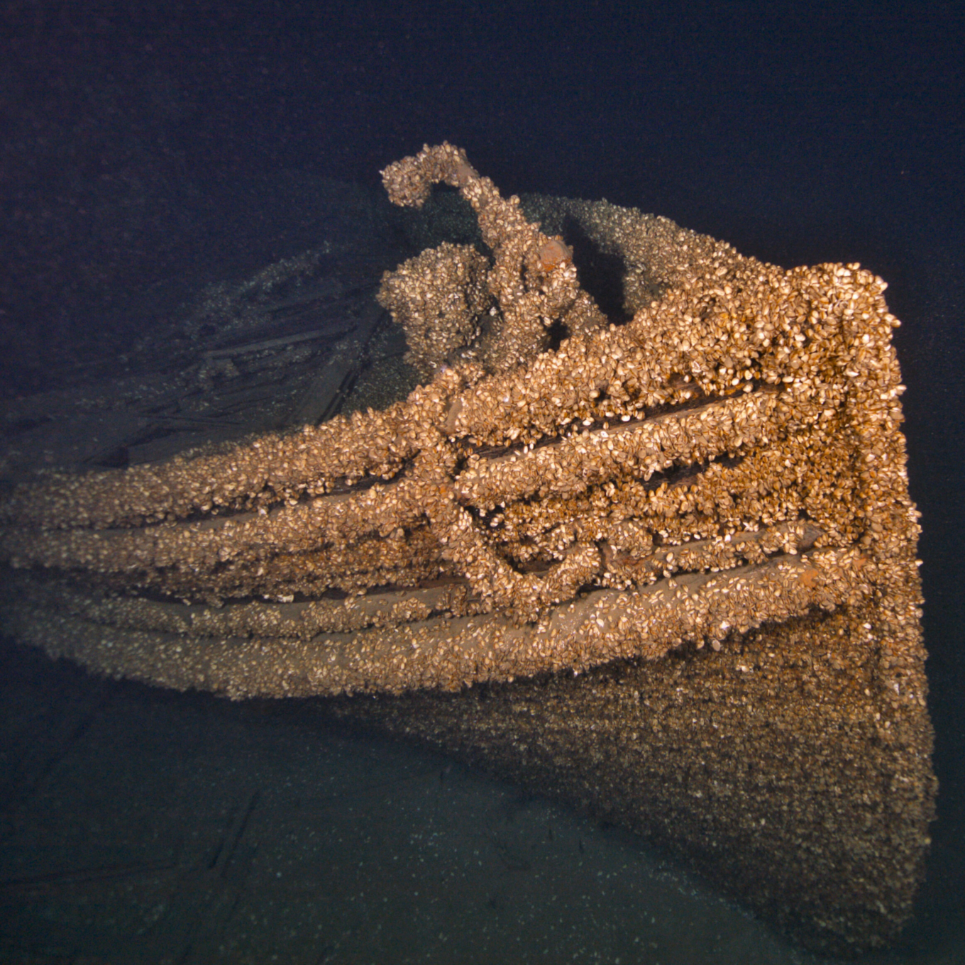
Credit: NOAA ONMS/OECI
Credit: NOAA ONMS/OECI