Project Overview
Coastal Sensing, a specialized hydrographic and marine geospatial services company, delivers high-resolution, decision-ready data across coastal, offshore, and inland water environments. Supporting the full lifecycle of marine projects, from site characterization and permitting through construction and long-term asset management, their work enables engineers, developers, regulators, and asset owners to make informed decisions with confidence.
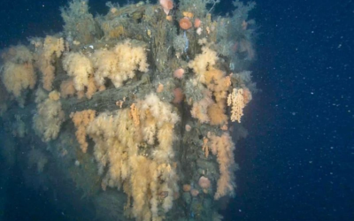
This case study highlights the development of a high-resolution 3D photogrammetry model of an armored pipeline located between Mercer Island and Bellevue in Lake Washington.
The Challenge
Subsea pipelines are critical infrastructure assets that require regular inspection to ensure structural integrity, environmental compliance, and operational reliability. However, accurately capturing their condition in low-visibility underwater environments presents several challenges:
- Limited visibility and lighting conditions
- Complex geometry of armored pipelines
- Need for precise geospatial alignment
- Requirement for both large-area context and fine-scale detail
Traditional single-sensor approaches often fall short, either lacking resolution or missing broader spatial context.
The Solution: A Multi-Sensor Approach
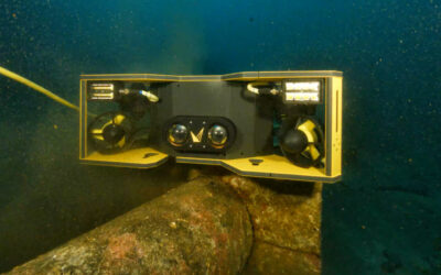
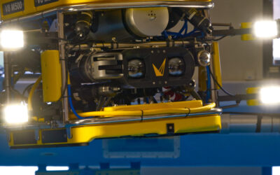
To address these challenges, Coastal Sensing deployed a multi-sensor ROV-based inspection strategy, combining:
- Forward Looking Sonar (FLS) for navigation and broad-area context
- Voyis Discovery Stereo Inspection Series for high-resolution optical imaging and 3D modeling
This integrated approach enables both large area awareness and localized detailed inspection, ensuring no critical details are missed.
Data Acquisition & Processing
The survey resulted in the acquisition of:
- Over 38,000 paired stereo images
- High-frequency positional (XYZ) data for each image
- Sonar datasets for contextual mapping and feature identification
The Voyis Discovery Stereo I-Series utilized synchronized strobe lighting with four LEDs in an off-axis configuration, minimizing backscatter and enhancing image clarity in challenging underwater conditions.
Each image was precisely tagged with geospatial data, enabling accurate alignment and reconstruction during post-processing.
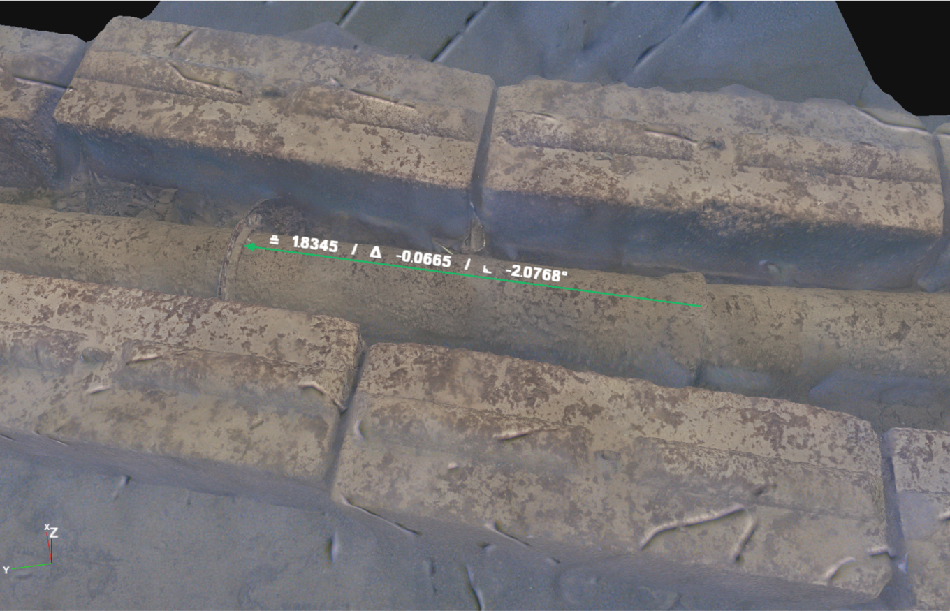
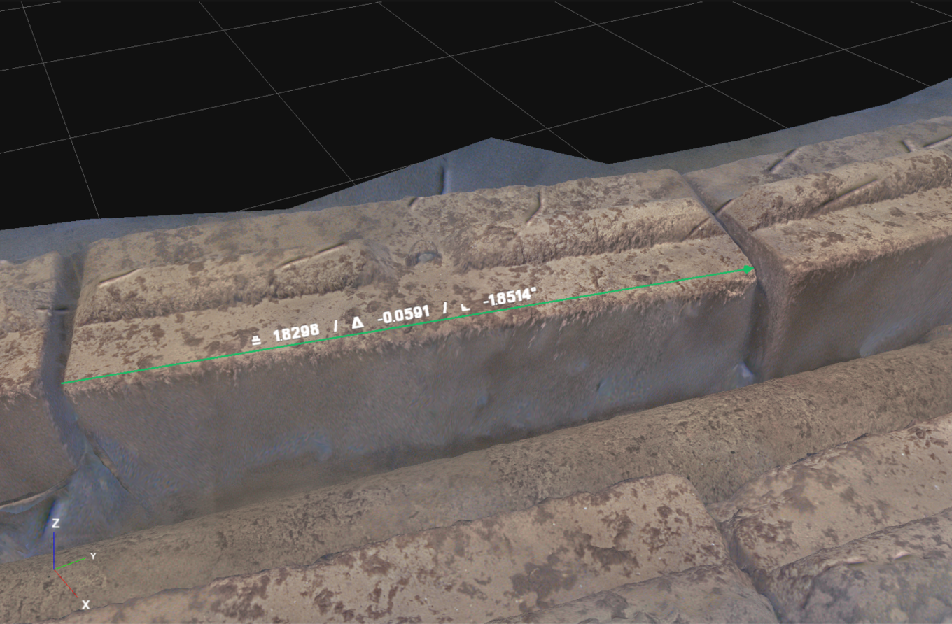
Precise dimensional measurement taken directly from a high-resolution 3D model generated by the Voyis Discovery Stereo Inspection Series for subsea pipeline inspection.
Results: High-Accuracy 3D Models Enabled by Advanced Stereo Imaging
At the core of the final deliverable was the Discovery Stereo I-Series, which enabled the generation of high-resolution, metrically accurate 3D models of the armored pipeline.
Leveraging true stereo vision, the system captured over 38,000 paired images, each precisely synchronized with positional (XYZ) data. This allowed for the reconstruction of a dense and highly accurate 3D photogrammetry model suitable for detailed inspection and quantitative analysis.
The system’s performance is further validated by Bureau Veritas (BV) certification, confirming sub-millimeter measurement accuracy. This level of precision enables:
- Reliable dimensional measurements directly from the 3D model
- Identification of small-scale defects, deformation, or damage
- Repeatable inspections for change detection over time
In addition, the use of synchronized strobe lighting with off-axis illumination significantly reduced backscatter, ensuring sharp image quality even in low-visibility conditions.
The result is a survey-grade digital twin of the pipeline, combining visual clarity with measurement confidence, allowing stakeholders to perform detailed, remote inspections without ambiguity.
Why Multi-Sensor Matters
This project demonstrates the importance of combining sonar and optical imaging in subsea inspections:
- Sonar provides reliable navigation and target detection in low visibility
- Optical imaging delivers the resolution required for detailed inspection
- Integrated datasets enable comprehensive understanding, from environment to asset condition
Relying on a single sensor would either limit detail or reduce situational awareness. Together, they create a complete and actionable dataset.
The Importance of Pipeline Inspection
Routine inspection of subsea pipelines is essential to:
- Ensure structural integrity and prevent failures
- Detect early signs of corrosion, damage, or displacement
- Maintain regulatory compliance
- Reduce risk of environmental impact
High-resolution 3D models further enhance these efforts by enabling repeatable, data-driven comparisons over time.
Conclusion
By leveraging a multi-sensor approach and the capabilities of the Discovery Stereo system, Coastal Sensing successfully delivered a high-resolution, georeferenced 3D model of a critical subsea asset.
This project highlights how advanced optical systems, when combined with sonar and precise navigation, can transform complex underwater environments into clear, actionable insights, supporting safer, more efficient marine operations.