Mine countermeasure (MCM) operations remain one of the most technically demanding subsea missions due to the need to balance large-area coverage with high-confidence target identification. Modern approaches are increasingly shifting toward integrated autonomous workflows, where multiple sensing modalities and platforms are combined to reduce operational risk, improve data quality, and accelerate decision-making.
Understanding the Stages of MCM Operations
An MCM mission is typically structured across three progressive stages: detection, classification, and identification.
The detection phase focuses on wide-area seabed surveying to identify anomalies. At this stage, efficiency and coverage are prioritized, with systems operating at higher altitudes to maximize spatial reach while maintaining sufficient sensitivity to detect potential targets.
The classification stage refines these initial detections by improving spatial resolution and contextual understanding. Here, operators aim to reduce uncertainty by re-acquiring contacts with higher fidelity sensor data, allowing benign objects to be separated from potential threats.
Finally, the identification stage provides definitive confirmation of a target’s nature. This requires close-range, high-resolution sensing capable of capturing fine structural detail. Increasingly, these stages are no longer treated as strictly linear but are instead integrated into adaptive workflows that allow for revisit, reclassification, and continuous refinement of the dataset.
The Role of the Eelume S3 AUV in High-Quality Data Acquisition
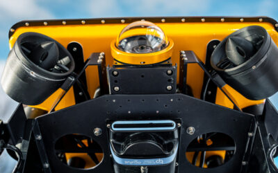
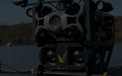
Within this evolving operational model, the Eelume S3 AUV introduces a highly adaptable approach to subsea data collection. Rather than focusing solely on autonomy or persistence, the strength of the system lies in the combination of its hydrodynamic platform design and the integration of advanced sensor payloads.
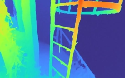
The articulated architecture of the vehicle enables controlled, precise maneuvering in complex subsea environments, particularly during close-proximity inspection tasks. This flexibility is critical when revisiting contacts identified during earlier MCM stages, where positional accuracy and stability directly influence data quality.
A defining characteristic of the system is the way its platform and sensor suite are engineered to work in unison. It is this coupling between vehicle dynamics and sensor performance that enables consistently high-quality datasets. The resulting capability aligns directly with three core operational outcomes: class-leading efficiency through optimized deployment and maneuvering, zero blind spots through the ability to position sensors effectively around complex targets, and precision imaging driven by stable, controlled data acquisition.
High-Resolution Seabed Imaging with the Solstice Multi-Aperture Sonar® from Forcys
Acoustic sensing continues to form the backbone of MCM detection and classification workflows, and multi-aperture sonar (MAS) represents one of the most effective technologies for high-resolution seabed imaging over wide areas.
The Forcys Solstice MAS system incoherently combines returns from multiple pings to greatly enhance the image signal-to-noise ratio, which in turn greatly reduces the distracting speckle-type noise so common in SAS imagery. This allows for more consistent image quality across the full 200m swath, improving the detectability of smaller or lower-contrast objects that might otherwise be overlooked.
Within an integrated MCM workflow, MAS plays a key role in reducing ambiguity early in the mission, enabling more confident classification and minimizing the need for repeated survey passes.
Optical Validation with Voyis High-Resolution 4K Imaging
While acoustic systems provide the foundation for detection and broad classification, optical imaging remains essential for final target confirmation. High-resolution 4K imaging systems developed by Voyis, the Observer Survey Series, provide the visual fidelity required to resolve fine-scale structural and material characteristics of identified contacts.
In the identification phase of MCM operations, optical data serves as the definitive layer of validation. When combined with precise navigation and controlled vehicle positioning, these imaging systems enable clear visual interpretation of objects, reducing uncertainty and supporting confident classification outcomes.
The strength of optical imaging in this context is not only its resolution but also its ability to provide contextual understanding that complements acoustic datasets, bridging the gap between detection and definitive identification.
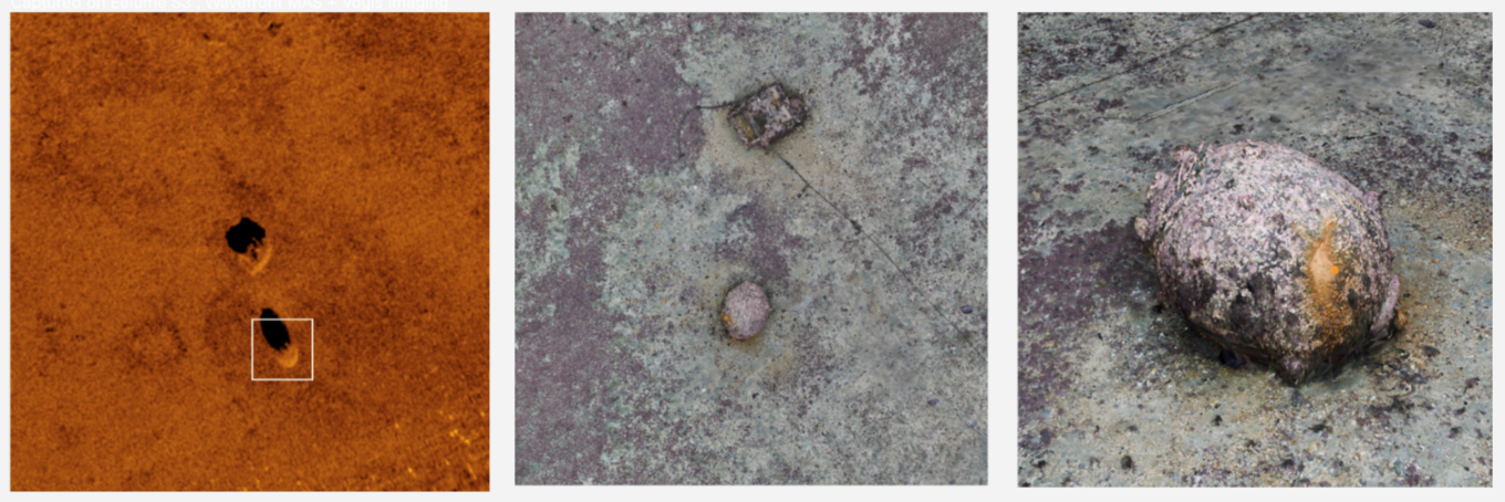
Mines captured on Eelume S3 , with Forcys Solstice MAS and Voyis Observer Survey Series Camera
Toward Integrated Multi-Sensor MCM Workflows
The combined application of Eelume’s S3 AUV platform, Forcys multi-aperture sonar, and Voyis high-resolution optical imaging reflects a broader shift in MCM operations toward tightly integrated, multi-sensor workflows.
Rather than treating detection, classification, and identification as discrete mission phases, these technologies enable a more fluid operational model where data can be refined iteratively and targets can be revisited with increasing resolution as needed. The result is a more efficient use of subsea assets, improved data continuity, and higher confidence in final decision-making.
As MCM operations continue to evolve, the emphasis is increasingly placed on data quality, operational efficiency, and the ability to generate actionable intelligence from complex subsea environments. Integrated systems such as these are central to that transition.