Voyis is proud to be a part of the Covelya group, alongside other admirable companies. Covelya Group companies operate in various sectors within the energy, science, defence and commercial markets. They develop, manufacture, sell and support instruments, systems, and solutions worldwide.
Today we are happy to introduce you to Wavefront and discuss how our technologies can work together for efficient seabed inspection and mapping.
Who is Wavefront?
Wavefront designs, develops, and manufactures a world-class range of imaging sonar systems for maritime security, defence and civilian markets
Established since 2004, Wavefront works with customers to ensure the unseen ocean environment is revealed. With their sonar systems, they provide protection for critical infrastructure, prevent collisions, provide imaging and monitor the integrity of undersea assets.
Voyis and Wavefront: Complementary Sensors for AUV Missions
The adoption of autonomous underwater vehicles (AUVs) is increasing, with these platforms continually advancing in capabilities and generated data deliverables. Sensors such as Wavefront’s Solstice and Voyis’ Recon enable these vehicles to perform at a level far beyond what has been expected allowing operators to make informed decisions quickly, safely, and cost effectively.
Combining the highly capable Solstice multi-aperture sonar with Voyis’ Recon LS laser and camera AUV module offers a complete surveying solution by consolidating the benefits of wide area mapping for general perspective with highly detailed 3D modeling and imaging for further identification/investigation.

Combined solution for environmental monitoring
Seagrass is a vital resource within a marine ecosystem, providing both food and shelter to many underwater creatures. Monitoring the state of seagrass beds is a critical aspect to understanding the health of the ecosystem in that environment.
One of the easiest ways to monitor seagrass and underwater vegetation is through modeling the size of the field, measuring the height of the seagrass year-over-year, and visually identifying any threats to the environment.
Using Wavefront’s Solstice deployed from an AUV, researchers can monitor the overall size of a seagrass bed by generating sonar data with wide swath coverage (200m) in high-resolution (0.15-degree along track resolution). The Solstice can combine side-scan imagery with bathymetric 3D data to deliver a detailed view of the bed and detect areas that require further investigation, like seen in the two pictures below.


Once areas of interest are identified, researchers can leverage the same AUV platform with Voyis’ Recon LS payload to perform a higher detailed optical inspection of the marine habitat to determine what factors are promoting or limiting growth of seagrass.
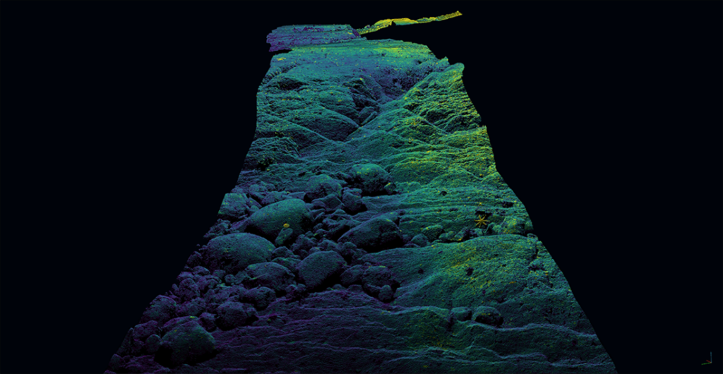
Extremely high-detail 3D models of vegetation can be created using Voyis’ laser scanning technology to accurately measure the height of seagrass (millimetric resolution) – like the pictures below show.
In addition, Voyis’ imaging systems provide crisp stills images simultaneously with true-colour corrections and onboard image enhancements offering the most detailed visual identification of areas of interest within the field.


Each sensor provides datasets that are accurately georeferenced to support researchers with analyzing rates of change over subsequent surveys with a single vehicle deployed.
It has been proven that the consolidated package of Voyis and Wavefront technology has enabled customers to minimize survey complexity, reduce the number of assets deployed for subsea surveys, and enable accurate change detection with detailed georeferenced datasets.
Contact us and Wavefront to learn more!


