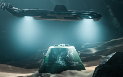
In underwater inspections, precision is not just preferred—it’s essential. The ability to gather reliable and comprehensive data in challenging underwater environments can make the difference between mission success and costly rework. The Voyis VSLAM Powered by EIVA NaviSuite solution brings a new level of certainty to these operations, ensuring that every inch of the surveyed area is covered with high-resolution data.
Ensuring Comprehensive Survey Data Quality Control
Underwater inspections often occur in environments with low visibility and unpredictable conditions. Traditional data collection methods in such settings can lead to incomplete or substandard data, resulting in coverage gaps and the potential need for additional surveys—both of which can drive up project costs and extend timelines.
The VSLAM solution with the Discovery Stereo Vision System, directly addresses these challenges by integrating visual simultaneous localization and mapping (VSLAM) technology with EIVA’s advanced NaviSuite software. This powerful combination facilitates real-time data visualization and quality control, ensuring the accuracy and completeness of the data collected.
Securing Reliable Data Collection
Data reliability is paramount in underwater inspection campaigns VSLAM technology significantly enhances this reliability by providing ongoing feedback on the ROV’s position and orientation. This feature is vital for maintaining data integrity, as it ensures that the survey path is precisely mapped, and all data points are accurately positioned.
With the Voyis VSLAM Powered by EIVA NaviSuite software, users can detect any inconsistencies with the datasets captured in real-time, rather than after the survey is complete. This allows the user to immediately correct the survey to improve data quality, reducing the risk of insufficient coverage, poor or inconsistent images, and ensures the final dataset is both dependable and ready for analysis.
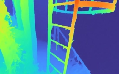
Supporting 3D Model Creation via Photogrammetry
For users who aim to create full 3D models of inspected areas through photogrammetry, full data coverage is crucial. Photogrammetry relies on overlapping images to reconstruct detailed three-dimensional models. Any gaps in data coverage can lead to incomplete or inaccurate models, compromising the ability to visualize the inspected area fully. The Voyis VSLAM Powered by EIVA NaviSuite solution ensures that every necessary data point is captured, enabling high-quality 3D model generation and providing a detailed visual record of the underwater environment.
This capability is particularly important for industries such as marine archaeology, offshore energy, and underwater infrastructure inspection, where accurate 3D models are used for analysis, planning, and documentation purposes.
Avoiding Rework Through Proactive Quality Control
Rework is one of the most significant drivers of cost and delays in underwater inspections. It often results from data gaps, poor data quality, or errors in the initial survey that were not detected until after the survey was completed. Voyis VSLAM Powered by EIVA NaviSuite mitigates these risks by incorporating proactive quality control throughout the survey process.
With the VSLAM solution, users can monitor data quality in real-time, identifying and addressing any issues immediately. This proactive approach reduces the likelihood of errors and ensures that the final dataset is complete and accurate. By avoiding rework, projects can stay on schedule and within budget, providing significant savings in both time and resources.