The Hunt For Shackleton’s Lost Ice Ship
History Of The Project
In February 2022, a major international scientific expedition will explore one of the coldest, harshest, and most remote locations in the world, with the goal to find and survey Sir Ernest Shackleton’s lost ship, the Endurance.
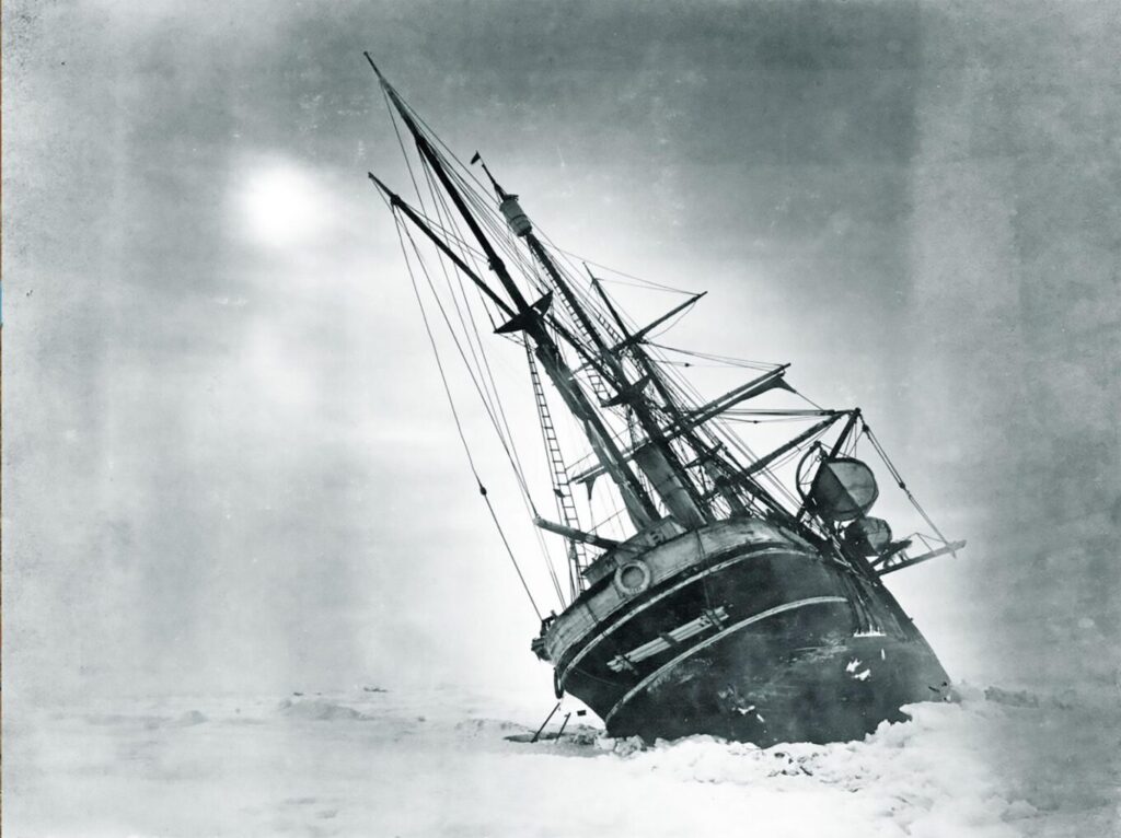
Endurance was one of two ships used by the Imperial Trans-Antarctic expedition of 1914–1917, which hoped to make the first land crossing of the Antarctic. Aiming to land at Vahsel Bay, it became stuck in pack ice on the Weddell Sea in February 1915, and later that same year, it finally sank.
The Expedition
Using state-of-the-art technology, including Voyis’ Insight Pro laser scanner and Observer Pro Imaging system, the Endurance22 expedition aims to be the first to locate and survey the Endurance.
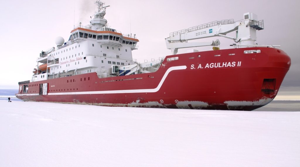
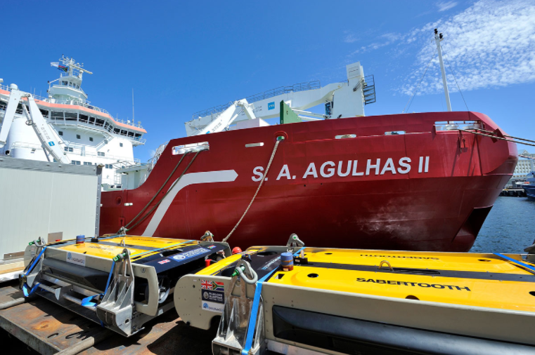
Organized and funded by The Falklands Maritime Heritage Trust (FMHT) and SEARCH, the Endurance22 expedition will bring together world-leading marine archaeologists, engineers, technicians, and sea-ice scientists. The crew will be onboard the S.A. Agulhas II, one of the world’s largest and most modern icebreaking and polar research vessels.
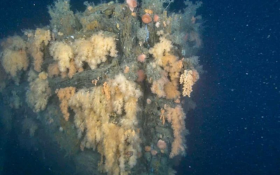
Crushed by the ice, the Endurance went down in 3000m of water. Due to overcast conditions, it was impossible to take their position by sextant on the day she sank. Therefore, the precise location of the Endurance is unknown.
Exploration
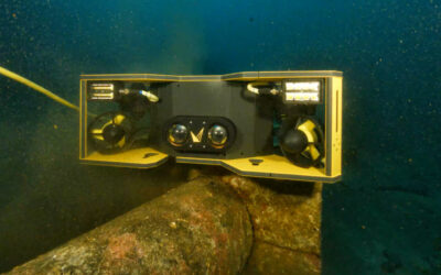
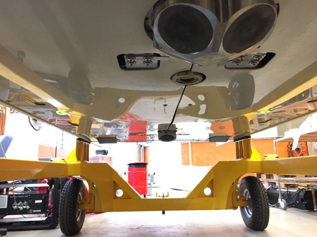
The Endurance22 Expedition will deploy two SAAB Sabertooth vehicles. These hybrid vehicles combine the features of a Remote Operating Vehicle (ROV) – tethered to the surface – and an Autonomous Underwater Vehicle (AUV) – capable of operating without such a link.
The Sabertooth vehicles can reach sites up to one hundred miles away from the ship from which they are launched. And with the help of Voyis’ technology, stream in real-time photos, and 3D volumetric point cloud survey data back to the topside mission control. This means that the expedition might be able to survey the wreck’s site, even if the sea ice conditions are complex, and the expedition ship S.A. Agulhas II cannot reach the location itself.

If the wreck is successfully located, the search team will use advanced underwater technology to digitally recreate the Endurance and surrounding debris field. Which is possible using highly accurate 3D models, and extremely crisp photography generated by Voyis’ Insight Pro laser scanner, Observer Pro stills cameras, and Nova LED panels.
Creating a Digital Twin
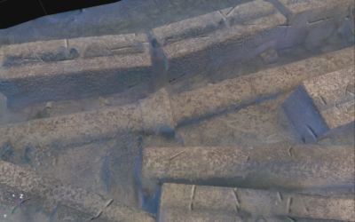
Using the Insight Pro laser scanner the survey team will be able to accurately map the Endurance. Our system broadcasts the ultra-dense point cloud model in real-time to the crew, digitally building up the shipwreck as they “fly” over the wreck with the Sabertooth vehicle.
Also, the team will follow a “lawnmower” pattern over top of the Endurance to adequately cover the entire wreckage and the debris field around it.
Complementing the Insight Pro system on this expedition is the Observer Pro imaging system, a long range, highly sensitive digital stills camera, and two extremely high output Nova LED panels to deliver crisp, evenly illuminated stills images.
The Observer Pro imaging system works seamlessly with the Insight Pro laser scanner, providing gapless laser data with interlaced stills. Additionally, images taken by the Observer system are automatically colour corrected using Voyis’ machine learning “True-Colour” correction, an onboard improvement that replicates the exact colour of the shipwreck if it were brought ashore, along with additional undistortion and light leveling algorithms to improve the image quality in real-time. Therefore, it will be possible to create photomosaics and photogrammetric models of the Endurance, to further compliment the highly accurate 3D point cloud model generated by the Insight Pro.
In the end, the resulting graphical data collected from Voyis’ Insight Pro and Observer Pro will be accurately scaled, producing a digital twin of Shackleton’s lost wreck to a level of precision comparable to that of an archaeological survey on land. Historical research and survey data collected by the expedition team will be used as baseline of information for the future monitoring and protection of the wreck of the Endurance.
Follow along with the expedition at https://endurance22.org/
Update on the Endurance Expedition
Three years after the Endurance was found, a documentary by National Geographic was released, telling the fascinating history of the ship and its crew, on top of the motivating story of the Expedition that was able to locate the ship.
And we can now share more details about our participation in the expedition, and how our technology was used for the 3D reconstruction of the Endurance.